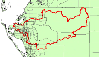
Lab 15 - Dasymetric Mapping
Simply put, dasymetric mapping distributes the use of ancillary data to improve on the challenges that come with spatial data aggregation and mismatched spatial boundaries. The most commonly used types of ancillary data include: land cover, impervious surfaces, road networks, and nighttime lights.
In this week's lab assignment, we practiced distributing data from one boundary to other boundaries by comparing dasymetric mapping and areal weighting scenarios. There are several considerations that a GIS user needs to consider when using dasymetric mapping, such as: understanding how well the ancillary data predicts population, testing calibration, and following internal logic (Zandbergen).
In this week's lab assignment, we practiced distributing data from one boundary to other boundaries by comparing dasymetric mapping and areal weighting scenarios. There are several considerations that a GIS user needs to consider when using dasymetric mapping, such as: understanding how well the ancillary data predicts population, testing calibration, and following internal logic (Zandbergen).

Comments
Post a Comment