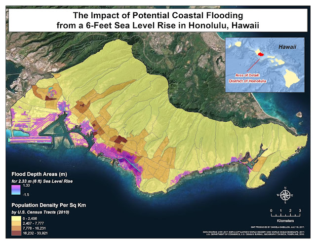
Module 7 - Coastal Flooding
This week we examined the impact of potential coastal flooding as a result of sea level rises and storm surges. For our lab assignment, we specifically used high resolution LiDAR (Light Detection and Ranging) DEM (Digital Elevation Model) data, U.S. Census data, and ArcGIS's Spatial Analyst Extension to 1. assess and delineate coastal flood zones of 3-feet and 6-feet sea level rises, 2. to determine the depth of flooding within these flood zones, and 3. to visually analyze the affected populations.

Comments
Post a Comment