Lab 2 - Physical Spatial Database Design & PostGIS Intro
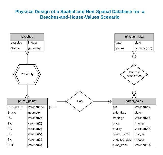
In this second module of my GIS 6105 Spatial Data Management class, we learned quite a lot. To begin with, we were tasked to create a physical design for a spatial database with the ultimate purpose of analyzing home values and proximity to the beach. For this part, we were provided a list of entities that have already been identified as important to the project, but the tricky part was that half of the entities were from non-spatial data. As a consequence, we had to also learn how to import .csv data in PostGIS after creating a schema, import shapefiles with a known SRID into PostGIS using the PostGIS Shapefile Import/Export tool, and then ran a simple query showing the first 10 records of two tables (one spatial, one non-spatial) to demonstrate that we were successful in our deliverables. Some sreenshots are provided below.


Comments
Post a Comment