Module 12 - NeoCartography & Google Earth
Module 12 is the last module of the semester for our Cartographic Skills class (before our Final Project, that is)! It included doing a short lab exercise in Google Earth, and it also included an expansive lecture and various reading assignments introducing us to the awakening of "NeoCartography".
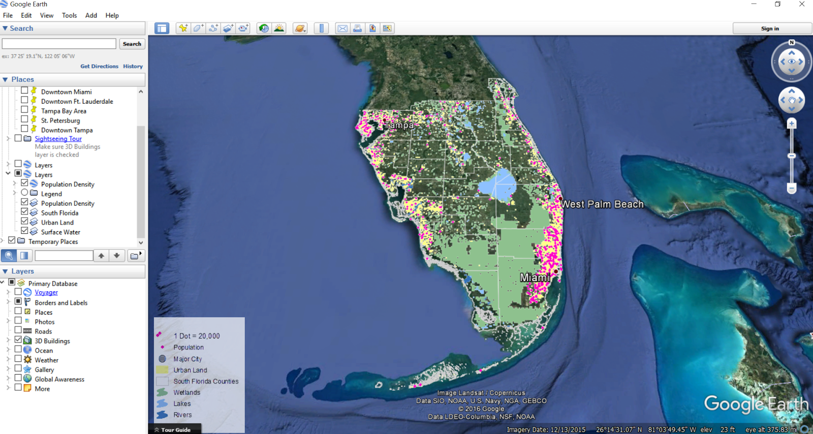
For our Google Earth lab, we learned how to convert both maps and layers to KML/KMZ files. As you can see from my screenshot above, we used the population Dot Density Map of South Florida that we created in Module 10 to do so. To more effectively use these files, it was emphasized that formatting and symbolization in ArcMap should be done before the conversion. Once we opened the KML/KMZ files into Google Earth, we learned how to make the legend appear within the map, and learned how to "save the places". Lastly, we learned how to create and record a tour in Google Earth by using the Placemarks and Record features, as well as turning on the 3D views. Although I've had previous experience converting KML/KMZ files, I definitely did not have any experience with the tour... in fact, I didn't even know that was possible. I found this feature to be so neat, and can foresee me using it in the future since as stated in class, Google Earth is a great GIS tool to use with those "who lack GIS knowledge and/or software... since it can easily be saved and shared with others".
The only challenging aspect I had with the lab was in being "smooth" whilst zooming in and out, and panning around in my tour (lol). What I did to work through this challenge was to just let my wrist and mouse go haywire for a few minutes so I could get the spasms out of the way. I rehearsed my tour twice before recording it in the 3rd attempt. You can click here if you would like to view my tour, but beware, it screams amateurism. Still, it was a fun activity and a great new skill to add to our growing GIS skillset.
Google Earth
For our Google Earth lab, we learned how to convert both maps and layers to KML/KMZ files. As you can see from my screenshot above, we used the population Dot Density Map of South Florida that we created in Module 10 to do so. To more effectively use these files, it was emphasized that formatting and symbolization in ArcMap should be done before the conversion. Once we opened the KML/KMZ files into Google Earth, we learned how to make the legend appear within the map, and learned how to "save the places". Lastly, we learned how to create and record a tour in Google Earth by using the Placemarks and Record features, as well as turning on the 3D views. Although I've had previous experience converting KML/KMZ files, I definitely did not have any experience with the tour... in fact, I didn't even know that was possible. I found this feature to be so neat, and can foresee me using it in the future since as stated in class, Google Earth is a great GIS tool to use with those "who lack GIS knowledge and/or software... since it can easily be saved and shared with others".
The only challenging aspect I had with the lab was in being "smooth" whilst zooming in and out, and panning around in my tour (lol). What I did to work through this challenge was to just let my wrist and mouse go haywire for a few minutes so I could get the spasms out of the way. I rehearsed my tour twice before recording it in the 3rd attempt. You can click here if you would like to view my tour, but beware, it screams amateurism. Still, it was a fun activity and a great new skill to add to our growing GIS skillset.
Comments
Post a Comment